
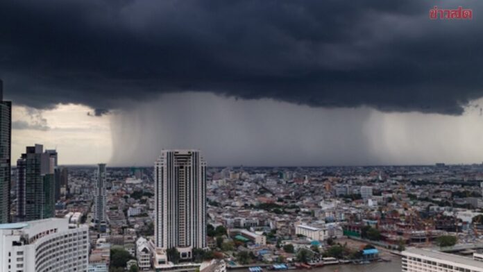
BANGKOK, THAILAND – Thailand’s weather service warns of heavy rain across multiple regions on August 13, 2026. Thunderstorms are expected over 60 percent of Bangkok and surrounding areas, with locally heavy downpours.
Flash floods and suddenly swelling streams are possible. The warning covers the north, northeast, central plains, east and south.
North and northeast hit by heavy rain in eight provinces
In the north, thunderstorms are expected over about 60 percent of the region. Heavy rain may hit Mae Hong Son, Chiang Rai, Phayao, Nan and Tak.
In the upper northeast, around 60 percent of the area is also affected by thunderstorms. The warning for locally heavy rain applies to Bueng Kan, Sakon Nakhon and Nakhon Phanom.
Central Thailand and east hit in seven provinces
In central Thailand, thunderstorms are expected over about 40 percent of the area. Heavy rain is possible in Uthai Thani, Saraburi and Kanchanaburi.
In the east, around 60 percent of the region should brace for thunderstorms. Nakhon Nayok, Chachoengsao, Chanthaburi and Trat may be affected.

Bangkok and vicinity remain in the rain zone
For Bangkok and adjacent areas, the weather service forecasts thunderstorms over about 60 percent of the region. Locally heavy rain is also possible there.
Temperatures in the capital region range from 25 to 27 degrees Celsius at night and reach 33 to 35 degrees during the day. The southwest wind blows at 10 to 25 kilometres per hour.
Southern Thailand: Rain along the Gulf coast
On the east coast of the Gulf of Thailand, thunderstorms are expected over about 40 percent of the area. This applies mainly to Phetchaburi, Surat Thani, Nakhon Si Thammarat, Phatthalung, Songkhla, Pattani, Yala and Narathiwat.
Temperatures range from 23 to 26 degrees at night to 33 to 36 degrees during the day. Waves one to two metres high are expected at sea; further offshore and during thunderstorms they can exceed two metres.
Andaman Sea: Heavy rain and high waves
On the west coast along the Andaman Sea, thunderstorms are expected in about 60 percent of the region. Phang Nga, Phuket, Krabi, Trang and Satun are named.
Temperatures there range from 24 to 27 degrees at night and 31 to 35 degrees during the day. From Phang Nga northward, the southwest wind blows at 20 to 40 kilometres per hour; waves reach two to three metres, and during thunderstorms more than three metres. From Phuket southward, waves about two metres high are expected, and during thunderstorms more than two metres.
Flash floods possible in vulnerable areas
The weather service attributes the conditions to a monsoon trough over the upper north, Laos and northern Vietnam. At the same time, the southwest monsoon over the Andaman Sea, Thailand and the Gulf of Thailand is relatively strong.
People in affected areas should be cautious of heavy and accumulating rain. Flash floods and rapidly draining water from forest areas can occur particularly on mountain slopes, near waterways and in low-lying areas.
Navigation warnings in the upper Gulf and upper Andaman Sea
In the upper Andaman Sea and the upper Gulf of Thailand, sea conditions are relatively rough. Waves of two to three metres are expected there, and during thunderstorms they can exceed three metres.
The weather service calls on sailors to navigate with caution and recommends avoiding thunderstorm areas. Small boats in the upper Andaman Sea and the upper Gulf of Thailand should not set sail.
Forecast valid until the next morning
The forecast applies from August 13 at 6 a.m. until August 14 at 6 a.m. Locally heavy rainfall is expected in the north, northeast, central region and east.
Temperatures reach 31 to 36 degrees depending on the region. The strongest winds are expected in the east and along parts of the southern coasts, reaching up to 40 kilometres per hour.