
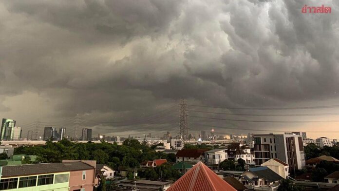
BANGKOK, Thailand – Weather officials warn of severe to very severe rain across the north, northeast, central region, east, and west coast of the south. A simultaneous warning covers rough seas in the Andaman Sea and Gulf of Thailand.
The Thai Meteorological Department sounded the alarm for July 29 and 30. A monsoon trough over northern and northeastern Thailand, plus a stronger southwest monsoon, drives the storms.
Monsoon trough brings massive downpours
Extreme rain amounts are expected in affected regions. The bureau tells the public to prepare for flash floods and rapidly rising waterways.
Runoff from the mountains poses a direct threat, especially on slopes and low-lying areas. Authorities urge caution in travel and daily plans.
High flash flood risk on slopes
The agency warns of flash floods and flowing water from hills, particularly on slopes and low-lying spots. Runoff can turn dangerous fast.
Care should be taken in travel and daily planning. Official weather information must be followed attentively.
said the Thai Meteorological Department.

Northeast and east hardest hit
Most of the northeast faces thunderstorms with locally heavy to very heavy rain. All provinces from Loei through Khon Kaen to Ubon Ratchathani are affected.
The east, including Chon Buri, Rayong, and Trat, also expects severe rainfall. Wind speeds there reach 20 to 35 kilometres per hour.
Wide parts of north under storm warning
Northern provinces like Chiang Mai, Chiang Rai, and Mae Hong Son are forecast thunderstorms and local heavy rain. Temperatures range from 22 to 35 degrees Celsius.
The central region around Nakhon Sawan, Lop Buri, and Saraburi also gets a heavy rain warning. Bangkok and its surroundings face thunderstorms of similar intensity.
Detailed weather data for each region
Rain probability sits between 60 and 80 per cent depending on the region. Nationwide temperatures vary from 22 to 35 degrees Celsius, with wind speeds from 10 to 40 kilometres per hour.
In the north, winds of 10 to 20 km/h are expected, and in the central region, 10 to 25 km/h. Exact values change by province and time of day.
Waves over three metres in the Andaman Sea
Sea conditions in the upper Andaman Sea, affecting west coast provinces Phang Nga and Ranong, are relatively strong. Wave heights of two to three metres are the norm.
In thunderstorm areas, waves climb above three metres. Small boats in the upper Andaman Sea should stay in port.
Dangerous waves also in the Gulf of Thailand
In the upper Gulf of Thailand and the southern Andaman Sea, waves reach about two metres. During thunderstorms, more than two metres are possible.
All sailors in the Andaman Sea and the Gulf of Thailand must avoid thunderstorm zones and navigate with caution. The warning covers both bodies of water entirely.
Agency opens hotlines for the public
The weather bureau provides information around the clock. Its website and phone numbers 0-2399-4012-13 and 1182 are available.
The agency urges careful planning of all activities in the coming days. Heavy rain and dangerous seas are expected until July 30.